1、MapGIS 数据处理 -瓦片裁剪2、IG Server发布服务3、JS SDK对接IG Server
一、MapGIS 裁剪瓦片
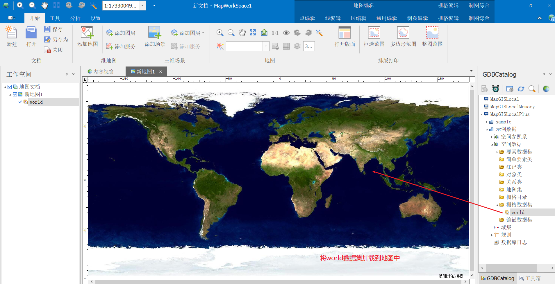
1、将Sample中world拖入新地图
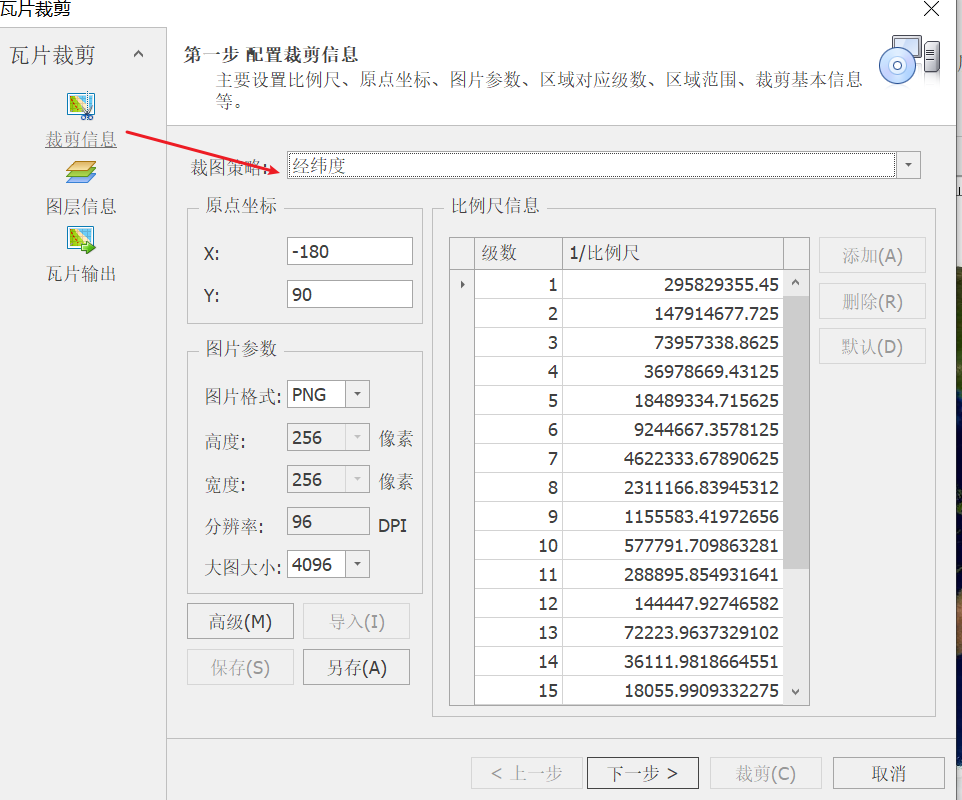
2、选择工具->瓦片裁剪
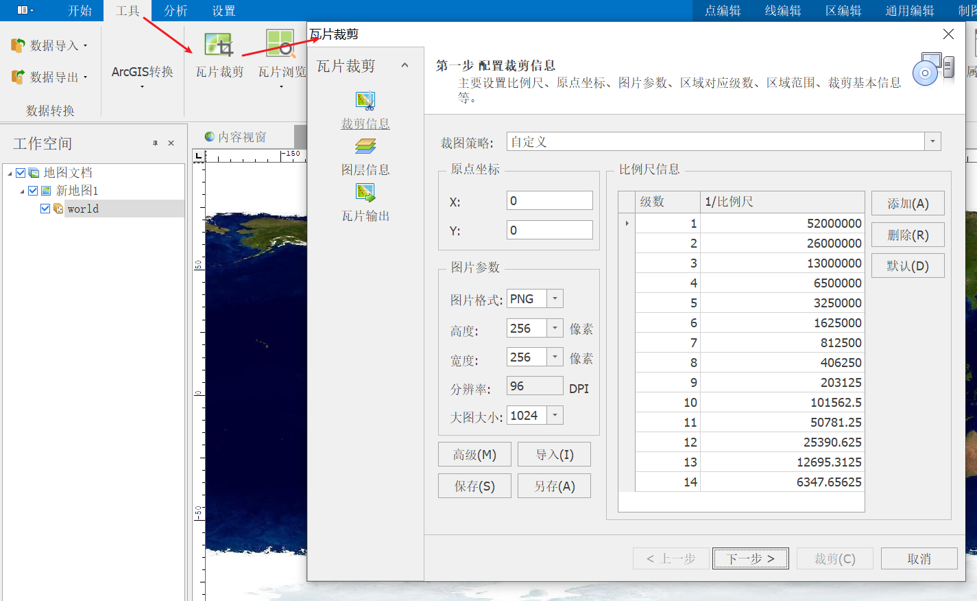
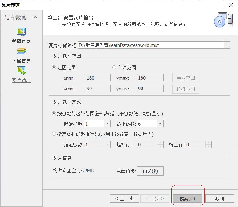
A、配置裁剪信息
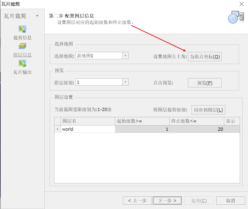
B、配置图层信息
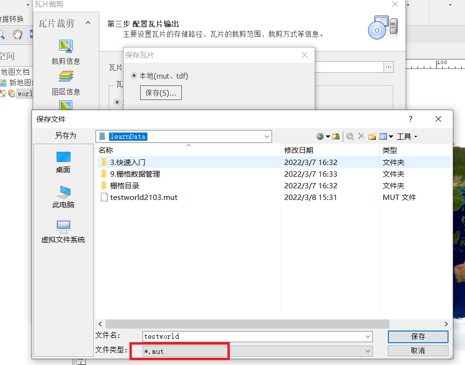
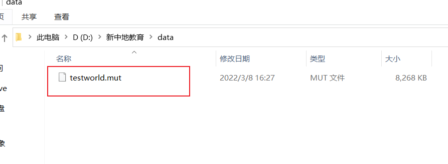
C、配置保存路径及设置数据格式
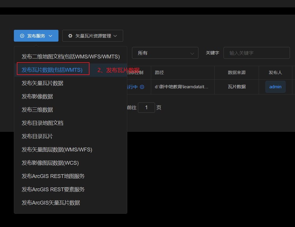
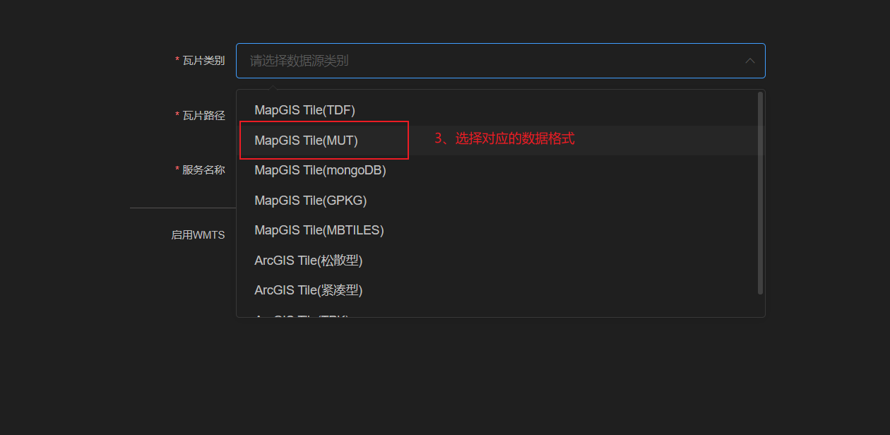
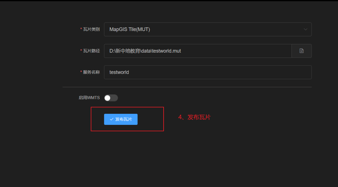
二、IG Server 发布瓦片
使用IG Server Manager发布瓦片数据集
通过浏览器访问localhost:9999登录后台,通过发布服务发布瓦片数据。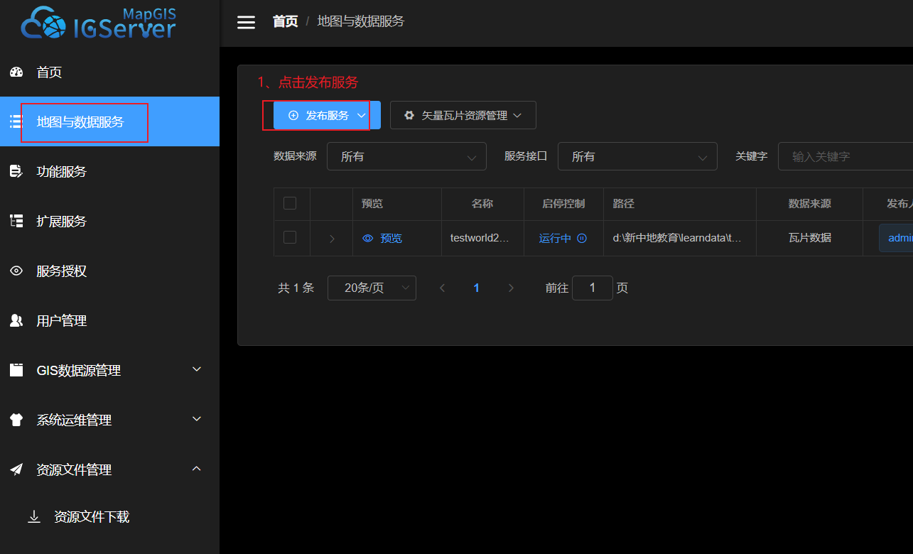
三、集成客户端
将下载的webSDK解压,将dist目录中的内容放到lib目录下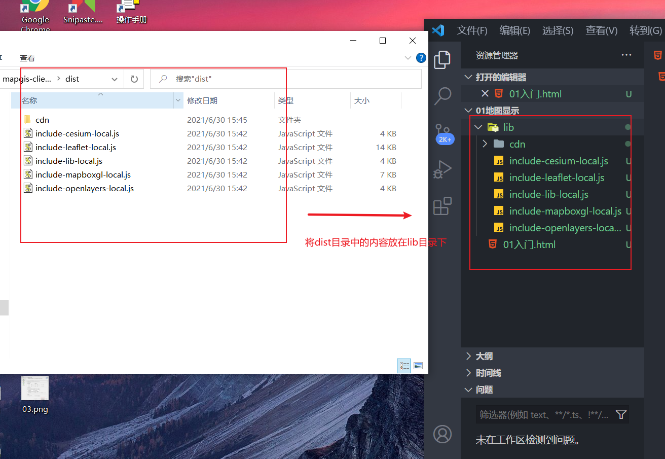
步骤
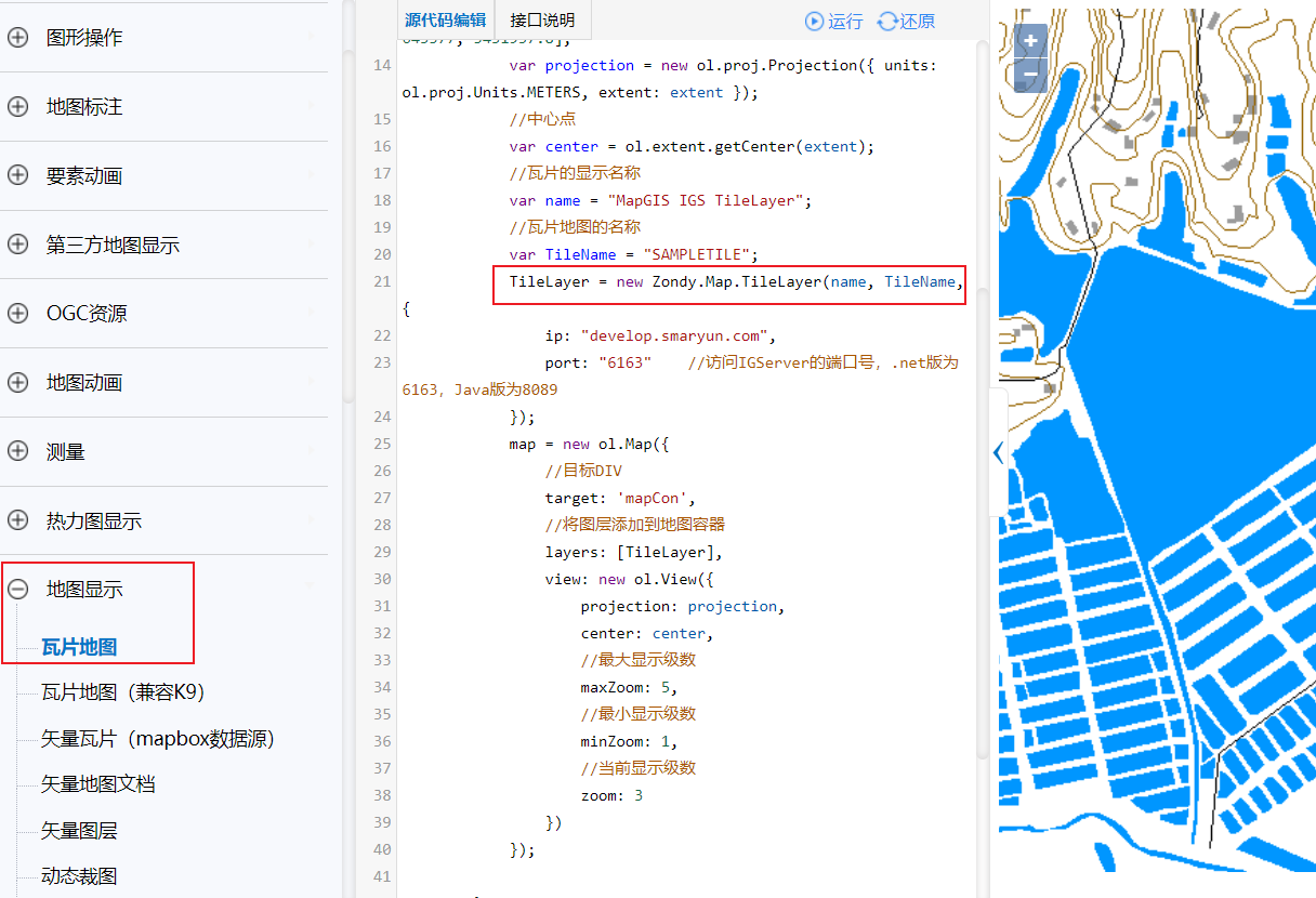
- 1、引入ol库
- 2、创建容器
- 3、实例化Map对象
示例代码 官方参考例子
<!DOCTYPE html><html lang="en"><head><meta charset="UTF-8"><meta http-equiv="X-UA-Compatible" content="IE=edge"><meta name="viewport" content="width=device-width, initial-scale=1.0"><title>Document</title><!-- 1、加载ol.js库 --><script src="lib/include-openlayers-local.js"></script></head><body><!-- 2、创建地图容器 --><div id="map_container"></div><script>/* 3、实例化地图容器加载瓦片图层 *//* 3-1 创建瓦片图层 */const tileLayer= new Zondy.Map.TileLayer('','testworld',{ip:'localhost',port:6163})console.log(tileLayer)/* 3-2 添加瓦片图层到地图容器 */const map = new ol.Map({/* 目标元素 */target:'map_container',/* 图层 */layers:[tileLayer],/* 视图 怎么去显示地图,以什么方式去显示地图 */view:new ol.View({/* 参考坐标系 */projection:'EPSG:4326',/* 中心点 */center:[0,0],/* 当前显示级数 */zoom:1})})</script></body></html>
世界地图EPSG:4326在世界地图方面,EPSG:4326是比较著名的一个,因为由美国主导的GPS系统就是在用它,它还有一个名气更大的别名叫作WGS84,WGS(World Geodetic System)是世界大地测量系统的意思,由于是1984年定义的,所以叫WGS84
3.1 EPSG:4326 (WGS84)
前面说了 WGS84 是目前最流行的地理坐标系统。在国际上,每个坐标系统都会被分配一个 EPSG 代码,EPSG:4326 就是 WGS84 的代码。GPS是基于WGS84的,所以通常我们得到的坐标数据都是WGS84的。一般我们在存储数据时,仍然按WGS84存储。
四、通过map的方法操作图层
主要实现图层的添加和删除
<!DOCTYPE html><html lang="en"><head><meta charset="UTF-8"><meta http-equiv="X-UA-Compatible" content="IE=edge"><meta name="viewport" content="width=device-width, initial-scale=1.0"><title>Document</title><!-- 1、加载ol库 --><script src="lib/include-openlayers-local.js"></script></head><body><!-- 2、创建地图容器 --><div id="map_container"><button onclick="addLayer()">添加图层</button><button onclick="removeLayer()">删除图层</button></div><!-- 3、实例化对象 --><script>/* 4、创建瓦片图层 */const tileLayer = new Zondy.Map.TileLayer('','testworld',{ip:'localhost',port:6163})const map = new ol.Map({/* 目标元素 */target:'map_container',/* 图层 */layers:[tileLayer],/* 视图 */view:new ol.View({projection:'EPSG:4326',/* 中心点 */center:[0,0],zoom:1})})function addLayer(){map.addLayer(tileLayer)}function removeLayer(){map.removeLayer(tileLayer)}</script></body></html>

若有收获,就点个赞吧
0 人点赞
